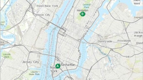
Low lying coastal areas have always dealt with the threat of water, but as climate change raises sea levels and strengthens storms, the threat may overcome old defenses. Using elevation data, you can create simple models of storm surges and predict which areas will flood the next time a hurricane hits. This lesson focuses on New York City as a study area, but the same workflow can be repeated for any coastal area.
Offered by

Related


HCP's experience in developing and implementing an e-learning strategy
Microlearning
![]() Blog
Blog
Offered by:
Samir Issara (Director of Human Resources and General Affairs, High Commission for Planning of Morocco (HCP))

Capacity-building: big data and the calculus of SDG indicators
Microlearning
![]() Blog
Blog
Offered by:
Dr. Bianca Walsh (Technical Assistant for the Director of the National School of Statistical Sciences (ENCE) at the Brazilian Institute of Geography and Statistics (IBGE))