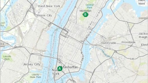
Low lying coastal areas have always dealt with the threat of water, but as climate change raises sea levels and strengthens storms, the threat may overcome old defenses. Using elevation data, you can create simple models of storm surges and predict which areas will flood the next time a hurricane hits. This lesson focuses on New York City as a study area, but the same workflow can be repeated for any coastal area.
Offered by

Related


Global Assessment Report on Disaster Risk Reduction (GAR19)
Resource
Training material
Offered by:
UNDRR


Transport for Sustainable Development - The case of inland transport
Resource
Document
Offered by:
UNESCWA